Logistic News - PLANTOUR Special
Due to the ongoing corona pandemic you have not heard from us for some time. We have used the time and bundled our resources to take PLANTOUR to a new level. The result is the new PLANTOUR Release 2021.
Never before have we included so many new features, functions and revisions in a version update as this time. These we would like to introduce to you briefly below.
Of course you can also contact our support team. We will be happy to show you the new features and arrange an update appointment with you.
What has been improved?
One can justifiably claim almost everything. We have improved or simplified, completely revised or replaced several areas in PLANTOUR. All with the goal of making the software easier, more functional and more attractive. We think we have succeeded in this.
The main innovations can be summarized as follows:
-
New look and feel and new user experience
-
New optimization algorithm: POS (PASS Optimizer Service)
-
Extensive improvement in routing and distance calculation
-
Improvements in the field of geocoding and coordinate mapping
-
Moving to the Cloud: PLANTOUR in cooperation with MAPSERVICES
-
Many professional and technical improvements
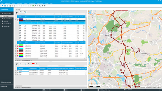
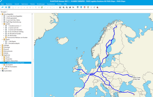
The new PLANTOUR layout brings a breath of fresh air! It consists of a straightforward design, new icons and modern colors as well as clearly structured menus. Another highlight are the new maps with much more details, including building geometries.
Also the administration has become easier. The Enterprise Manager is completely merged with PLANTOUR and users with administrator rights have the functions automatically integrated in the software. This not only saves time but also server capacity.
New optimization service POS
We have already introduced it in several newsletters, now it is available in the current PLANTOUR version: our new algorithm PASS Optimization Service (POS).
It works strictly cost-based and allows you to control your optimization goal in a fine-grained way. While the previous algorithms, such as savings, had a relatively rigid priority regarding optimization by distance or time, the new POS allows individual control via cost rates. This means that you control an optimal tour: as fast as possible, as short as possible, as few vehicles as possible, etc.)
Regardless of this, the new POS also offers many functions that the existing algorithms do not have on the feature list: Pickup & Delivery, more options for break regulation, individual consideration of the fleet in terms of costs and restrictions, etc.
More details, more overview
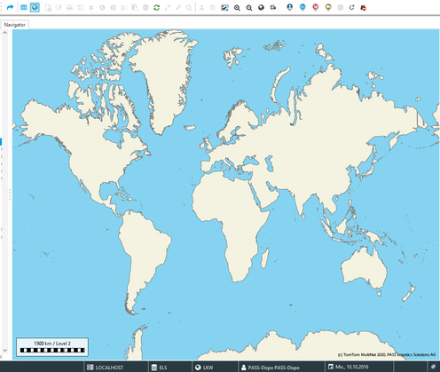
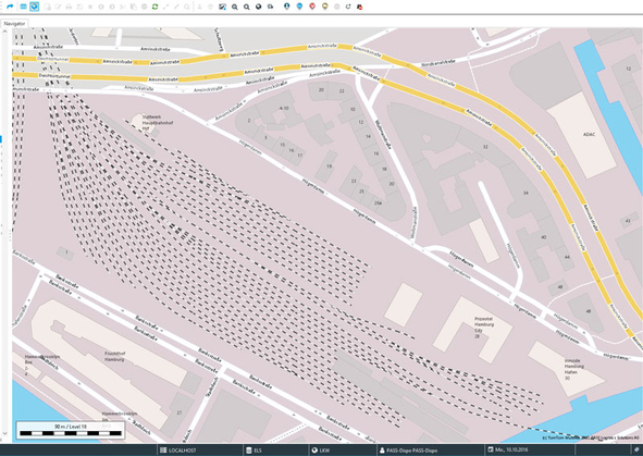
In the past the PLANTOUR map stopped at D-A-CH and the roads were the end of the detail level. The new PLANTOUR maps were created with love for detail. Our software now shows the world, individual buildings, a more detailed railroad network, and an improved representation of water areas and forest areas.
Improved route planning
Until now, several steps in the form of network calculation and coordinate intersection were necessary before the actual planning. This is now a thing of the past. From now on all this happens automatically or is calculated in real time. Addresses are automatically "snapped" to the next street to the nearest meter, driving distances are calculated to the second. Thus, PLANTOUR has become "CEP-capable", i.e. entire streets can be planned with meter accuracy. Building geometries and coordinate snapping are particularly helpful in graphical geocoding to ensure the exact location.
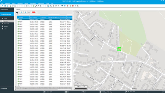
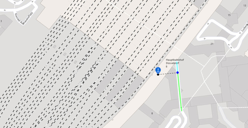
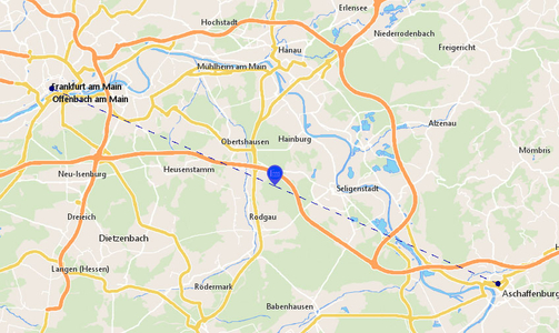
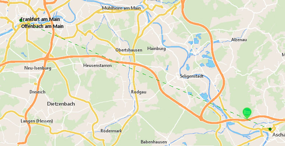
In addition, the treatment of restrictions has been considerably extended. Checks for passage restrictions are now much more efficient and alternative routes can be found more easily. When planning with restrictions, the dispatcher receives detailed information whether a stop can generally not be approached because there are restrictions on the route, or whether the destination is located on a restricted road and only the last meters to the delivery point are problematic (see image).
Historical traffic data in the map profile
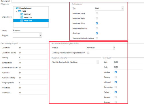
Speeds and journey times are now much more accurate, as historical data regarding speed and traffic flow are included for each road section at 5-minute intervals, and not just the maximum permitted speed as was previously the case. This means that profiles for rush hour or night traffic can be generated and travel times calculated much more accurately.
Furthermore, restrictions can be controlled much more fine-grained. In general, certain restrictions are avoided and only used when necessary. PLANTOUR navigates on the shortest way out of pedestrian zones and only enters them if the destination is within these zones.
Better geocoding via POIs
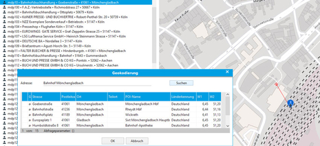
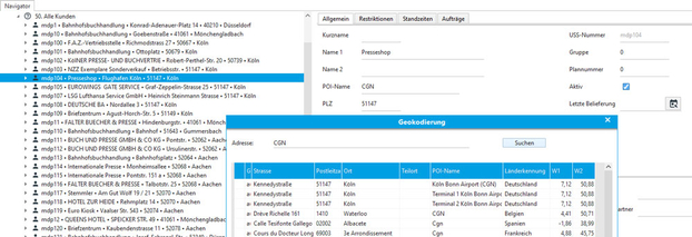
It is certainly a great help for chain stores or direct suppliers to be able to use an extensive POI library for geocoding automatically. Simply enter the name of the discount store, shopping mall or company in the customer base. Geocoding uses this information for easier location. Airport codes can also be used for searching.
Location optimization with delivery frequencies
There are also innovations in the location optimization module: We now take delivery frequencies into account , a feature that is often requested and desired. Here, too, a picture is worth a thousand words: On the left picture, both times a delivery frequency of 1, on the right picture a ratio of 10 to 1.
Technical innovations
Here, too, we have introduced optimizations that are not only relevant for the administrator. The most important innovation is that PLANTOUR can now also pull map data, route planning and geocoding from the cloud up to the optimization service. For this we have linked PLANTOUR with our MAPSERVICES. This has the advantage that we take care of updating the map data in the background and that they automatically work with the latest algorithms and data. Your PLANTOUR data such as customer, orders and tours remain with you.
Your benefit: If you use our cloud services, you can operate PLANTOUR with a smaller server in the future.
